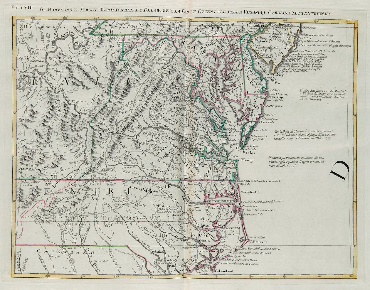
Maryland, Southern New Jersey, Delaware and the Eastern Part of Virginia and North Carolina, Engraving by G. Zuliani from Tome I of the "Newest Atlas" by G. Zuliani

Maryland, Southern New Jersey, Delaware and the Eastern Part of Virginia and North Carolina, Engraving by G. Zuliani from Tome I of the "Newest Atlas"

(Maryland, southern New Jersey, Delaware and the eastern part of Virginia and North Carolina, engraving by G. Zuliani taken from Tome I of the "Newest Atlas" published in Venice in 1778 by Antonio Zatta, Private Collection)


G. Zuliani

€ 114.31
Enthält 0% MwSt.
   Configure art print
Undated  ·  Picture ID: 991669

Nonclassified artists

Maryland, Southern New Jersey, Delaware and the Eastern Part of Virginia and North Carolina, Engraving by G. Zuliani from Tome I of the "Newest Atlas" by G. Zuliani. Available as an art print on canvas, photo paper, watercolor board, uncoated paper or Japanese paper.
/ Bridgeman Images
AR/3D   View in 3D / AR zu Favoriten hinzufügen   Add to favorites    Select wall color    View painting in a room
0 Reviews

Configure art print

Picture Frame

Medium & Stretcher

Glass & Passepartout

Miscellaneous & Extras

 Save / compare configuration
Preview Icon

Summary

Gemälde
Veredelung
Keilrahmen
Museumslizenz

€ 114.31
(inkl. 20% MwSt)
   Add to cart

Bildschärfe: PERFEKT

Should you desire adjustments to brightness and color, or a custom crop of the motif, we are happy to make these changes at no additional cost to you. Please do not hesitate to contact us.

Similar artworks selected for you

Land of the Cherokees with the western part of North Carolina and Virginia, engraving by G. Zuliani taken from Tome I of the North America, engraved by Richard William Seale, 1752 A Map of the British and French Dominions in America A New and General Map of the Middle Dominion Belonging to the United States, 14th May 1794 Acadia, the Provinces of Sagadahoc and Maine, New Hampshire, Rhode Island and Part of Massachusetts and Connecticut, Engraving by G. Zuliani A Map of the United States of North America Outlines of the Physical and Political Divisions of South America A Map of the United States of North America A Map of the Most Inhabited Part of Virginia by Fry and Jefferson South-east Coast of America, from A Map of the British and French Dominions in America Map of The British Governments in North America, engraved by J. Gibson North-East Coast of America, from A Map of the British and French Dominions in North America A Map of the Inhabited part of Virginia by Fry and Jefferson A new map of the United States of America, from the latest authorities A Map of the Province of New York with Part of Pennsylvania, and New England, from an Actual Survey by Captain Montrésor, Engineer, 1775 Canada, English Colonies with Louisiana and Florida Eastern Part of Canada, Northern Nova Scotia and Part of Labrador, Engraving by G. Zuliani A Map of North America - Revolutionary War Land of Outagamie, Mascoutin, Illinois Indians and part of the Six Nations, engraving by G. Zuliani taken from Tome I of the A Map Exhibiting All the New Discoveries in the Interior Parts of North America America A Map of the British and French Dominions in America Map of the United States of America according to the Treaty of Peace of 1783 A General Map of the Middle British Colonies in America; viz. Virginia, Maryland, Delaware, Pennsylvania, New Jersey, New York, Connecticut, and Rhode Island: of Aquanishuonigy, the Country of the Confederate Indians... Of the Lakes Erie, Ontario and Ch Pennsylvania, New York, southern New Jersey, with the western part of Connecticut, Massachusetts Bay and Land of the Iroquois, engraving by G. Zuliani taken from Tome I of the Map of the United States, 1816 Colchis, Iberia, Albania and Caucasian Tribes
Show more similar artworks

Other art prints by G. Zuliani

Political Map of Italy, Engraving by G. Zuliani from Volume IV of the "Newest Atlas" Maryland, Southern New Jersey, Delaware and the Eastern Part of Virginia and North Carolina, Engraving by G. Zuliani from Tome I of the "Newest Atlas" Ancient Spain Divided into Three Distinct Areas, Namely Terraconensis, Lusitania and Baetica, Engraving by G. Zuliani from Tome I of the "Newest Atlas" Land of the Ottawa and Kilistine Indians Around Lake Superior and a Supplement of Eastern Florida, Engraving by G. Zuliani from Tome I of the "Newest Atlas" Island of Sicily, divided into its valleys The Kingdoms of Sweden, Denmark and Norway, Engraving by G. Zuliani from Tome III of the "Newest Atlas" World Map and a General Description of the Globe, Engraving by G. Zuliani from the Newest Atlas Land area of the State of the Veneto, engraving by G. Zuliani from Southern Hemisphere of the Earth cut at the equator, engraving by G. Zuliani taken from Tome I of the Newest Atlas published in Venice in 1779 by Antonio Zatta Province of Middlesex, Engraving by G. Zuliani from Tome I of the "Newest Atlas" The Grand Duchy of Tuscany, engraving by G. Zuliani from Land of the Cherokees with the western part of North Carolina and Virginia, engraving by G. Zuliani taken from Tome I of the Land Area of the State of the Veneto: Brescia, Engraving by G. Zuliani from the Newest Atlas The Barbary Coast or The Kingdoms of Morocco, Fez, Algeria, Tunisia and Tripoli with Surrounding Countries, Engraving by G. Zuliani from Tome IV of the "Newest Atlas" The Palatinates of Posnania, Gniesno, Brzesc, Kalisz and Inovroclav, Engraving by G. Zuliani from Tome III of the "Newest Atlas"
Discover more works by G. Zuliani

Excerpt from our top sellers

Poppy Field Group of Egrets, 1925-36 A Young Girl Defending Herself against Eros Lake Geneva with Mont-Blanc in Morning Red Emilie Floege The Apple Harvest Time for a Bathe, Valencia The Entrance to the Grand Canal, Venice The Stages of Life The Magpie Flower Still Life on a Marble Ledge Moonlight over Lake Lucerne Girl with a Pearl Earring Trinity Standing Male Nude
Show More Artworks


What our customers think about us


Frequently Asked Questions about Meisterdrucke


Personalizing your art print at Meisterdrucke is a simple and intuitive process that allows you to design an artwork exactly to your specifications: Choose a frame, determine the image size, decide on a printing medium, and add suitable glazing or a stretcher frame. We also offer customization options such as mats, fillets, and spacers. Our customer service is available to help you design your perfect artwork.

At Meisterdrucke, you have the fascinating option to visualize the artwork you configured directly in your own space. For a tailored preview, simply upload a photo of your room and let the artwork appear on it. If you visit us via a mobile device, be it a phone or tablet, our augmented reality feature brings the image to life and seamlessly projects it into your space. An experience that uniquely combines art and technology.

Choosing the medium is often a matter of personal taste. To give you a clearer idea, we have provided some images for each medium. For a holistic experience, we also offer you a sample set of all paper variants so you can make a decision not just visually but also haptically. You can take advantage of the sample set free of charge – only the shipping costs will apply. You can order the sample set directly.

Do not worry. At Meisterdrucke, we do not proceed mechanically. We manually review each order. If there are any inconsistencies or peculiarities in the configuration, we will immediately contact you. Of course, our courteous and patient support is always at your side to assist you with the configuration. Together with you, we adjust your image by phone or email so that the final result exactly meets your expectations.


Do you have any questions?

Are you interested in an art print from our manufactory but still unsure? Do you need advice on choosing the medium or help with the order?

Our experts are happy to assist you.

+43 4257 29415
support@meisterdrucke.com
Mo-Do: 7:00 - 16:00 | Fr: 7:00 - 13:00

Do you have any questions?

Are you interested in an art print from our manufactory but still unsure? Do you need advice on choosing the medium or help with the order?

Our experts are happy to assist you.

+43 4257 29415
support@meisterdrucke.com
Mo-Do: 7:00 - 16:00 | Fr: 7:00 - 13:00


Meisterdrucke

   Kärntner Strasse 46
        9586 Finkenstein am Faaker See
        Austria
        +43 4257 29415
        support@meisterdrucke.com
Other languages

                   
Erfahrungen & Bewertungen zu Meisterdrucke
Post.at DHL Express Quehenberger Cargoboard
Kaiser Franz Joseph

Meisterdrucke
Kärntner Strasse 46
9586 Finkenstein am Faaker See · Austria
+43 4257 29415 · office@meisterdrucke.com
Post.at DHL Express Quehenberger Cargoboard


Meisterdrucke 2705 Bewertungen auf ProvenExpert.com

(c) 2025 meisterdrucke.us